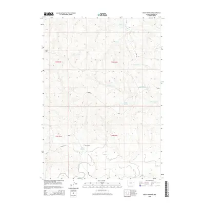
2015 Map of Boggy Reservoir
USGS Topo · Published 2015About this map
Boggy Reservoir and a series of numbered catchments define the water management landscape of this high plains corner of Niobrara County. The map reveals an intricate network of seasonal drainage, where Boggy Cr and Lance Cr carve through the terrain alongside named features like Clayton Draw and Marcus Draw. This system of reservoirs, including the Brenner Reservoir and several Beardsley and Dogie units such as E Number 1 Beardsley Reservoir and Dogie Number 3 Reservoir, illustrates the vital infrastructure required for ranching and land use in this arid Wyoming environment. Grounded by family-named routes like Wasserburger Rd and Redbird Rd, the map provides a clear picture of the rural infrastructure and land boundaries in the early twenty-first century.
Find a feature on this map
19 named features on this map. Tap any name to fly to it.
Don’t see what you’re looking for? This feature index may not catch every label — zoom into the map to look around manually.
Map Details
Editions of this 2015 Boggy Reservoir Map
This is the sole edition of this map. No revisions or reprints were ever made.
Other maps of this area

1955 · Newcastle
USGS Topo · 1:250,000

1958 · Newcastle
USGS Topo · 1:250,000

1981 · Horseshoe Bend
USGS Topo · 1:24,000

1981 · Threemile Butte
USGS Topo · 1:24,000

1981 · Dixon Ranch
USGS Topo · 1:24,000

1981 · Lance Creek NW
USGS Topo · 1:24,000
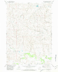
1981 · Boggy Reservoir
USGS Topo · 1:24,000
1981 · Funny Rock
USGS Topo · 1:24,000
1981 · Buck Creek Hills
USGS Topo · 1:24,000

1981 · Garland Draw
USGS Topo · 1:24,000