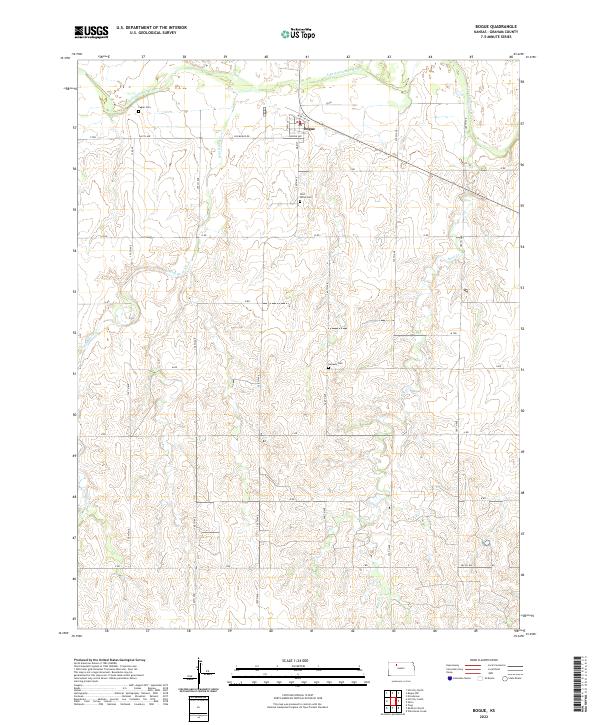
2022 Map of Bogue
USGS Topo · Published 2022About this map
Bogue serves as the primary settlement center on this Graham County landscape, situated along the northern banks of the S Fork Solomon River. The terrain is defined by a dendritic drainage pattern where Wild Horse Cr and Sand Cr carve through the agricultural uplands. This 2022 survey reveals a rural infrastructure built upon a rigid grid of section-line roads, including Old Bogue Rd and numerous numbered avenues. For those tracing local heritage, the map identifies three significant burial sites distributed across the townships: Fagan Cem to the northwest, Wild Horse Cem near the town center, and Samuels Cem to the south. These landmarks, along with named streets like Oriole Ave and Main St, provide specific geographic anchors for modern-day researchers and genealogists.
Find a feature on this map
32 named features on this map. Tap any name to fly to it.
Don’t see what you’re looking for? This feature index may not catch every label — zoom into the map to look around manually.
Map Details
Editions of this 2022 Bogue Map
This is the sole edition of this map. No revisions or reprints were ever made.
Other maps of this area

1893 · Hill
USGS Topo · 1:125,000

1955 · Beloit
USGS Topo · 1:250,000

1959 · Beloit
USGS Topo · 1:250,000

1969 · Nicodemus
USGS Topo · 1:24,000

1969 · Palco
USGS Topo · 1:24,000

1979 · Bogue
USGS Topo · 1:24,000

1979 · Hill City South
USGS Topo · 1:24,000
1979 · Hill City 4 NW
USGS Topo · 1:24,000
1979 · Bogue NW
USGS Topo · 1:24,000
1979 · Wild Horse Creek
USGS Topo · 1:24,000