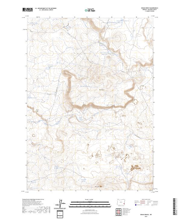
2023 Map of Bogus Bench
USGS Topo · Published 2023About this map
Bogus Bench and the prominent Bogus Rim define the high desert topography of this Malheur County landscape. The map reveals a sophisticated network of water management essential for ranching and survival in this arid region, featuring numerous named catchments such as Indian Camp Reservoir, Lava Sinks Reservoir, and the Bogus-Bench Reservoir. These features, often paired with volcanic markers like West Crater, suggest a history of human adaptation to a complex geological environment.
Find a feature on this map
25 named features on this map. Tap any name to fly to it.
Don’t see what you’re looking for? This feature index may not catch every label — zoom into the map to look around manually.
Map Details
Editions of this 2023 Bogus Bench Map
This is the sole edition of this map. No revisions or reprints were ever made.
Other maps of this area

1955 · Jordan Valley
USGS Topo · 1:250,000

1955 · Boise
USGS Topo · 1:250,000

1957 · Jordan Valley
USGS Topo · 1:250,000

1958 · Boise
USGS Topo · 1:250,000

1958 · Jordan Valley
USGS Topo · 1:250,000

1962 · Boise
USGS Topo · 1:250,000

1969 · Jordan Craters South
USGS Topo · 1:24,000

1969 · Jordan Craters North
USGS Topo · 1:24,000
1969 · Threemile Hill
USGS Topo · 1:24,000

1972 · Owyhee Butte
USGS Topo · 1:24,000