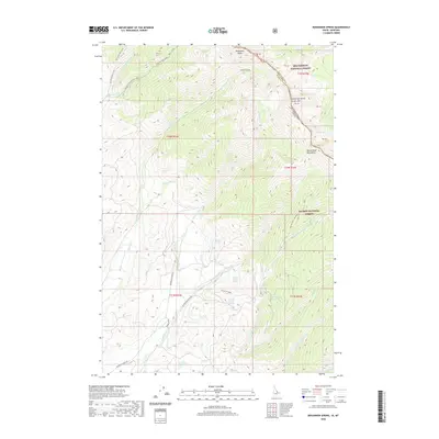
2020 Map of Bohannon Spring
USGS Topo · Published 2020About this map
The Continental Divide crests through the high country along the border of Lemhi and Beaverhead counties, where the high ridgelines of the Beaverhead Mountains separate the watersheds of Idaho and Montana. This high-altitude landscape is defined by its complex drainage network, where the headwaters of Bohannon Creek and Geertson Creek flow through the Salmon National Forest toward the valleys below. The map reveals a history of seasonal water access through numerous named sources such as Bohannon Spring, Chet Rowe Spring, and Sawmill Gulch Spring. The presence of Coal Mine Gulch Spring and several forest roads, including Bohannon Creek Road, suggest a landscape historically utilized for resource extraction and forestry. High peaks like Sacajawea Peaks and Center Mountain overlook remote alpine features such as Berry Lake, providing a clear record of the area's physical geography and boundary markers.
Find a feature on this map
43 named features on this map. Tap any name to fly to it.
Don’t see what you’re looking for? This feature index may not catch every label — zoom into the map to look around manually.
Map Details
Editions of this 2020 Bohannon Spring Map
This is the sole edition of this map. No revisions or reprints were ever made.
Other maps of this area

1950 · Salmon
USGS Topo · 1:62,500

1951 · Salmon
USGS Topo · 1:62,500

1955 · Dillon
USGS Topo · 1:250,000

1956 · Goldstone Mtn
USGS Topo · 1:62,500

1957 · Dillon
USGS Topo · 1:250,000

1958 · Dillon
USGS Topo · 1:250,000

1962 · Dillon
USGS Topo · 1:250,000

1965 · Dillon
USGS Topo · 1:250,000

1966 · Badger Spring Gulch
USGS Topo · 1:24,000

1966 · Miner Lake
USGS Topo · 1:24,000