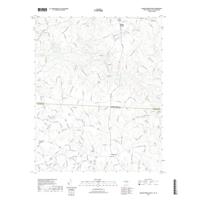
2019 Map of Boiling Springs South
USGS Topo · Published 2019About this map
Boiling Springs serves as the primary northern anchor for this study, which tracks the transition from North Carolina into South Carolina along the Broad River. The landscape is defined by the winding river valley and the numerous tributaries that feed it, including Sandy Run, Sarratt Cr, and Cherokee Cr. This terrain necessitated early local infrastructure that remains visible, such as Steel Bridge Rd and several family-named landmarks. The map captures a high density of rural burial grounds and places of worship, including the Cherokee Creek Baptist Church Graveyard and Mount Pleasant Church. Further south, the rural character is punctuated by the Gaffney Airport and the settlement of Grassy Pond. This document is particularly valuable for genealogists, as it meticulously records small, often isolated burial sites like Camps Creek Cem and Jolley Cem alongside larger landmarks like Cleveland Memorial Park.
Find a feature on this map
162 named features on this map. Tap any name to fly to it.
Don’t see what you’re looking for? This feature index may not catch every label — zoom into the map to look around manually.
Map Details
Editions of this 2019 Boiling Springs South Map
This is the sole edition of this map. No revisions or reprints were ever made.
Other maps of this area

1909 · Gaffney
USGS Topo · 1:62,500

1950 · Shelby
USGS Topo · 1:62,500

1953 · Charlotte
USGS Topo · 1:250,000

1954 · Charlotte
USGS Topo · 1:250,000

1959 · Cowpens
USGS Topo · 1:62,500

1960 · Charlotte
USGS Topo · 1:250,000

1962 · Charlotte
USGS Topo · 1:250,000

1966 · Forest City
USGS Topo · 1:24,000
1971 · Boiling Springs South
USGS Topo · 1:24,000
1971 · Blacksburg South
USGS Topo · 1:24,000