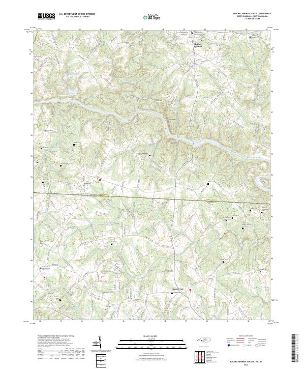
2022 Map of Boiling Springs South
USGS Topo · Published 2022About this map
Gardner-Webb University anchor the northern edge of this survey, defining the community of Boiling Springs. This area of the Piedmont is characterized by a high concentration of small family and community burial grounds, illustrating the deep genealogical roots of Cleveland Co and Cherokee Co across the state line. The Broad River winds through the center of the sheet, carving a path between Flint Hill and Jolly Mtn before crossing into South Carolina.
Find a feature on this map
171 named features on this map. Tap any name to fly to it.
Don’t see what you’re looking for? This feature index may not catch every label — zoom into the map to look around manually.
Map Details
Editions of this 2022 Boiling Springs South Map
This is the sole edition of this map. No revisions or reprints were ever made.
Other maps of this area

1909 · Gaffney
USGS Topo · 1:62,500

1950 · Shelby
USGS Topo · 1:62,500

1953 · Charlotte
USGS Topo · 1:250,000

1954 · Charlotte
USGS Topo · 1:250,000

1959 · Cowpens
USGS Topo · 1:62,500

1960 · Charlotte
USGS Topo · 1:250,000

1962 · Charlotte
USGS Topo · 1:250,000

1966 · Forest City
USGS Topo · 1:24,000
1971 · Boiling Springs South
USGS Topo · 1:24,000
1971 · Blacksburg South
USGS Topo · 1:24,000