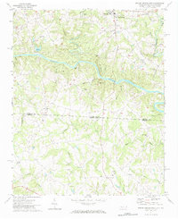
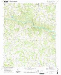
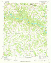
1971 Map of Boiling Springs South
USGS Topo · Published 1984About this map
Gardner Webb College anchors the northern landscape of this region during the early 1970s, situated just west of the community of Boiling Springs. This area is defined by the significant corridor of the Broad River, which carves through the terrain between Cleveland County and Cherokee County. The map reveals a deeply rooted rural social structure, evidenced by the numerous country churches like Mt Pleasant Ch and Lavonia Ch that serve the surrounding agricultural and timbered lands. Local recreation and utility are represented by a Dragstrip near Beaverdam Creek, a Golf Course to the south, and the man-made Lake Houser. The transition from the Piedmont hills of North Carolina into the upper reaches of South Carolina is marked by a network of drainage creeks, including Sandy Run and Cherokee Creek, which have dictated the placement of early settlements and roads for generations.
Find a feature on this map
40 named features on this map. Tap any name to fly to it.
Don’t see what you’re looking for? This feature index may not catch every label — zoom into the map to look around manually.
Map Details
Editions of this 1971 Boiling Springs South Map
3 editions found
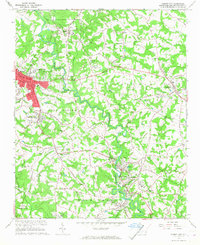
Other maps of this area

1909 · Gaffney
USGS Topo · 1:62,500
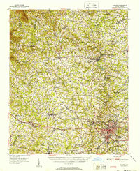
1950 · Shelby
USGS Topo · 1:62,500

1953 · Charlotte
USGS Topo · 1:250,000

1954 · Charlotte
USGS Topo · 1:250,000

1959 · Cowpens
USGS Topo · 1:62,500

1960 · Charlotte
USGS Topo · 1:250,000

1962 · Charlotte
USGS Topo · 1:250,000
1966 · Forest City
USGS Topo · 1:24,000
1971 · Boiling Springs South
USGS Topo · 1:24,000
1971 · Blacksburg South
USGS Topo · 1:24,000