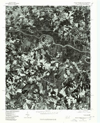
1976 Map of Boiling Springs South
USGS Topo · Published 1978About this map
Boiling Springs anchors the northern edge of this mid-1970s orthophoto, a rare photographic perspective that reveals the true texture of the Piedmont landscape before modern suburban sprawl. The aerial imagery highlights a patchwork of active agricultural fields and dense woodland, centered around the winding course of the Broad River as it cuts across the center of the sheet. Further south, the settlement of Grassy Pond appears as a distinct cluster of structures amidst the rural acreage. Unlike traditional topographic maps, this photographic survey provides immediate visual evidence of land use, forest cover, and rural road patterns exactly as they existed in May 1976, offering a clear view of the area's transition between North and South Carolina.
Find a feature on this map
3 named features on this map. Tap any name to fly to it.
Don’t see what you’re looking for? This feature index may not catch every label — zoom into the map to look around manually.
Map Details
Editions of this 1976 Boiling Springs South Map
This is the sole edition of this map. No revisions or reprints were ever made.
Other maps of this area

1909 · Gaffney
USGS Topo · 1:62,500

1950 · Shelby
USGS Topo · 1:62,500

1953 · Charlotte
USGS Topo · 1:250,000

1954 · Charlotte
USGS Topo · 1:250,000

1959 · Cowpens
USGS Topo · 1:62,500

1960 · Charlotte
USGS Topo · 1:250,000

1962 · Charlotte
USGS Topo · 1:250,000

1966 · Forest City
USGS Topo · 1:24,000
1971 · Boiling Springs South
USGS Topo · 1:24,000
1971 · Blacksburg South
USGS Topo · 1:24,000