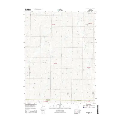
2014 Map of Bolckow NW
USGS Topo · Published 2014About this map
Whitecloud sits near the eastern edge of this Missouri landscape, where the headwaters of numerous creeks carve a dendritic pattern into the terrain. The northern reaches of the county line between Nodaway Co Andrew Co are defined here by agricultural sections and a network of secondary roads such as Galaxy Rd and Hallmark Rd. Local history and family genealogy are anchored by established burial grounds including Shamberger Cemetery in the west and Litchfield Cemetery in the southeast corner. The drainage of White Cloud Cr and Jenkins Cr dominates the hydrology, illustrating the persistent rural character of the region into the early 21st century. A modern addition to this traditional farming landscape is the Show Me the Sky Airport, located just north of the county boundary.
Find a feature on this map
42 named features on this map. Tap any name to fly to it.
Don’t see what you’re looking for? This feature index may not catch every label — zoom into the map to look around manually.
Map Details
Editions of this 2014 Bolckow NW Map
This is the sole edition of this map. No revisions or reprints were ever made.
Other maps of this area

1926 · Maitland
USGS Topo · 1:62,500

1927 · Bolckow
USGS Topo · 1:62,500

1939 · Skidmore
USGS Topo · 1:62,500

1941 · Skidmore
USGS Topo · 1:62,500

1942 · Skidmore
USGS Topo · 1:62,500

1943 · Maryville
USGS Topo · 1:62,500

1945 · Bolckow
USGS Topo · 1:62,500

1955 · Nebraska City
USGS Topo · 1:250,000

1957 · Nebraska City
USGS Topo · 1:250,000

1958 · Nebraska City
USGS Topo · 1:250,000