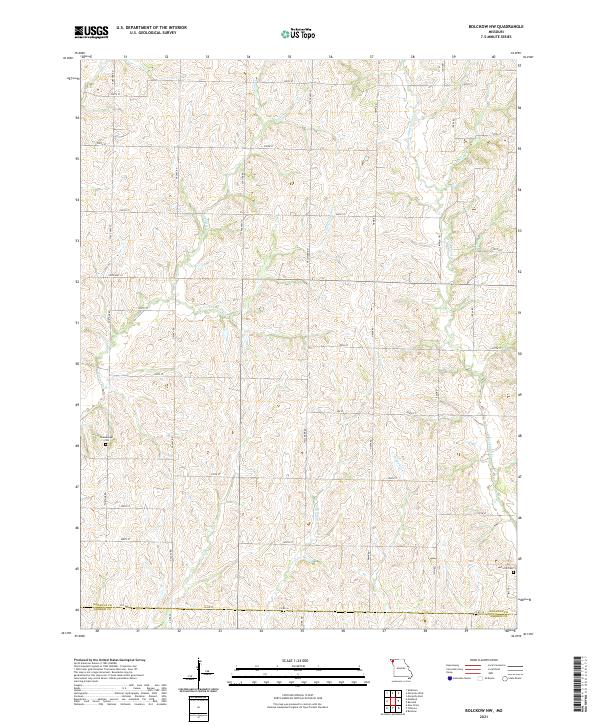
2021 Map of Bolckow NW
USGS Topo · Published 2021About this map
The boundary between Nodaway Co and Andrew Co cuts across the southern portion of this landscape, defining a rural expanse dominated by a dense network of drainage systems. Waterways like Jenkins Cr, White Cloud Cr, and Arapahoe Cr have etched a complex series of ridges and valleys into the Missouri terrain. This topographic structure influenced the placement of the section-line road network, including arterial routes like State Hwy H and Fortune Rd. Genealogists and local historians can find family markers at Shamberger Cem in the west and Litts Cem near the eastern edge, both situated on elevated ground above the surrounding creek basins. The map illustrates a contemporary rural environment where the placement of cemeteries and roads remains deeply tied to the natural hydrology of the E Fork Jenkins Cr and Newland Cr watersheds.
Find a feature on this map
38 named features on this map. Tap any name to fly to it.
Don’t see what you’re looking for? This feature index may not catch every label — zoom into the map to look around manually.
Map Details
Editions of this 2021 Bolckow NW Map
This is the sole edition of this map. No revisions or reprints were ever made.
Other maps of this area

1926 · Maitland
USGS Topo · 1:62,500

1927 · Bolckow
USGS Topo · 1:62,500

1939 · Skidmore
USGS Topo · 1:62,500

1941 · Skidmore
USGS Topo · 1:62,500

1942 · Skidmore
USGS Topo · 1:62,500

1943 · Maryville
USGS Topo · 1:62,500

1945 · Bolckow
USGS Topo · 1:62,500

1955 · Nebraska City
USGS Topo · 1:250,000

1957 · Nebraska City
USGS Topo · 1:250,000

1958 · Nebraska City
USGS Topo · 1:250,000