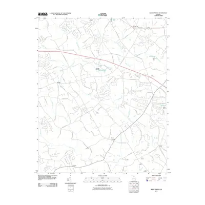
2011 Map of Bold Springs
USGS Topo · Published 2011About this map
Williamson Creek and the Apalachee River carve through this North Georgia landscape, defining the rural character of Barrow and Gwinnett counties. Small settlements and crossroads like Whistleville, Harbin, and Bold Springs anchor the area, connected by historic routes such as the Bankhead Hwy. The map reveals a dense network of family-named burial grounds, including Midway Cemetery, Omer Cemetery, and Still Cemetery, which provide vital touchpoints for genealogists tracing ancestral roots in the region.
Find a feature on this map
107 named features on this map. Tap any name to fly to it.
Don’t see what you’re looking for? This feature index may not catch every label — zoom into the map to look around manually.
Map Details
Editions of this 2011 Bold Springs Map
This is the sole edition of this map. No revisions or reprints were ever made.
Other maps of this area

1891 · Gainesville
USGS Topo · 1:125,000

1896 · Monroe
USGS Topo · 1:125,000

1953 · Athens
USGS Topo · 1:250,000

1954 · Greenville
USGS Topo · 1:250,000

1958 · Greenville
USGS Topo · 1:250,000

1958 · Athens
USGS Topo · 1:250,000

1959 · Athens
USGS Topo · 1:250,000

1963 · Athens
USGS Topo · 1:250,000

1964 · Hog Mountain
USGS Topo · 1:24,000

1964 · Bold Springs
USGS Topo · 1:24,000