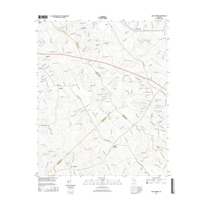
2014 Map of Bold Springs
USGS Topo · Published 2014About this map
The Apalachee River and Alcovy River define the undulating landscape of this Georgia Piedmont region, where the borders of Barrow, Gwinnett, and Walton counties converge. In 2014, the area reflects a transition from rural crossroads to residential expansion, particularly around Bold Springs and Windsor. Historical roots remain visible through numerous family and community burial grounds, including the Alcovy Cem, Omer Cem, and Kilgore Cem, which are scattered among the ridges between the river forks. Major transit corridors like Ga-316 and the Atlanta Hwy NW cut through the northern portion of the map near Dacula, signaling the corridor's role in connecting local communities to the broader regional economy. While water features like Rutledge Lake and Marbury Lake dot the terrain, the smaller tributaries such as Drowning Cr and Williamson Cr illustrate the intricate drainage patterns that have shaped land use in this corner of Georgia for generations.
Find a feature on this map
36 named features on this map. Tap any name to fly to it.
Don’t see what you’re looking for? This feature index may not catch every label — zoom into the map to look around manually.
Map Details
Editions of this 2014 Bold Springs Map
This is the sole edition of this map. No revisions or reprints were ever made.
Other maps of this area

1891 · Gainesville
USGS Topo · 1:125,000

1896 · Monroe
USGS Topo · 1:125,000

1953 · Athens
USGS Topo · 1:250,000

1954 · Greenville
USGS Topo · 1:250,000

1958 · Greenville
USGS Topo · 1:250,000

1958 · Athens
USGS Topo · 1:250,000

1959 · Athens
USGS Topo · 1:250,000

1963 · Athens
USGS Topo · 1:250,000

1964 · Hog Mountain
USGS Topo · 1:24,000

1964 · Bold Springs
USGS Topo · 1:24,000