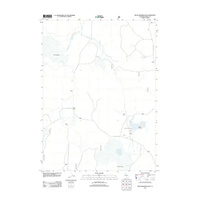
2012 Map of Boles Meadow East
USGS Topo · Published 2012About this map
Boles Meadow and the expansive Antelope Plains dominate this high-desert landscape in northeast California, where water management and ranching define the local geography. The map illustrates a network of drainage and storage including Bottle Cr, Fletcher Cr, and several catchments such as Reservoir G and West Black Rock Reservoir. Human activity is centered on sites like the Round Valley Ranch and Ulbright, reflecting the region's agricultural and pastoral legacy. Forest Service roads crisscross the terrain, providing access to landmarks like the Reservoir C Campground in Williams Valley. This survey captures the specialized infrastructure required for life in a semi-arid environment, from the small Coyote Springs to the larger flats of Dutch Flat.
Find a feature on this map
31 named features on this map. Tap any name to fly to it.
Don’t see what you’re looking for? This feature index may not catch every label — zoom into the map to look around manually.
Map Details
Editions of this 2012 Boles Meadow East Map
This is the sole edition of this map. No revisions or reprints were ever made.
Other maps of this area

1886 · Alturas
USGS Topo · 1:250,000

1892 · Alturas
USGS Topo · 1:250,000

1954 · Alturas
USGS Topo · 1:250,000

1958 · Alturas
USGS Topo · 1:250,000

1962 · Alturas
USGS Topo · 1:250,000

1962 · Big Sage Reservoir
USGS Topo · 1:62,500

1962 · Steele Swamp
USGS Topo · 1:62,500

1962 · South Mountain
USGS Topo · 1:62,500

1962 · Jacks Butte
USGS Topo · 1:62,500

1965 · Alturas
USGS Topo · 1:250,000