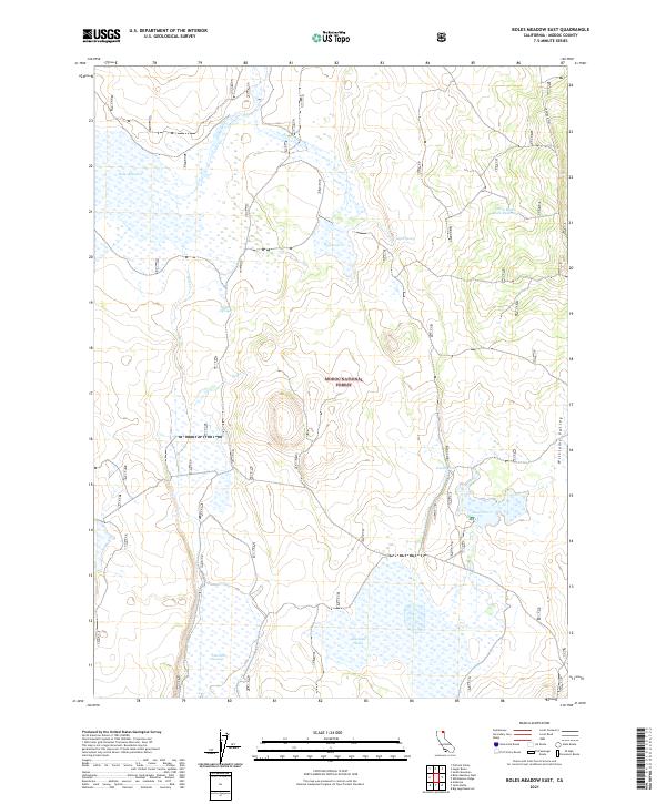
2021 Map of Boles Meadow East
USGS Topo · Published 2021About this map
Modoc National Forest encompasses this high-elevation landscape in northeastern California, where seasonal water management and natural drainage define the terrain. The presence of numerous designated catchment areas, including West Black Rock Reservoir, Reservoir G, and Reservoir C, points to a history of water storage for range management and wildlife within the forest boundaries. Water flows across the plateau through Fletcher Cr and Boles Cr, feeding into marshy basins such as Boles Meadow and the sprawling Fairchild Swamp in the southern reaches.
Find a feature on this map
21 named features on this map. Tap any name to fly to it.
Don’t see what you’re looking for? This feature index may not catch every label — zoom into the map to look around manually.
Map Details
Editions of this 2021 Boles Meadow East Map
This is the sole edition of this map. No revisions or reprints were ever made.
Other maps of this area

1886 · Alturas
USGS Topo · 1:250,000

1892 · Alturas
USGS Topo · 1:250,000

1954 · Alturas
USGS Topo · 1:250,000

1958 · Alturas
USGS Topo · 1:250,000

1962 · Alturas
USGS Topo · 1:250,000

1962 · Big Sage Reservoir
USGS Topo · 1:62,500

1962 · Steele Swamp
USGS Topo · 1:62,500

1962 · South Mountain
USGS Topo · 1:62,500

1962 · Jacks Butte
USGS Topo · 1:62,500

1965 · Alturas
USGS Topo · 1:250,000