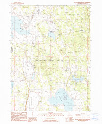
1990 Map of Boles Meadow East
USGS Topo · Published 1990About this map
The Modoc National Forest dominates this northeastern California landscape, where high-elevation basins and seasonal waters dictate the pattern of settlement and land use. Near the western boundary, the X.L. Ranch Indian Reservation borders a region marked by cattle ranching history, evidenced by the Round Valley Ranch (Site) and scattered corral features. The terrain transitions from the open stretches of Antelope Plains to the marshy expanse of Fairchild Swamp, reflecting a complex hydrological system of natural creeks and man-made impoundments.
Find a feature on this map
24 named features on this map. Tap any name to fly to it.
Don’t see what you’re looking for? This feature index may not catch every label — zoom into the map to look around manually.
Map Details
Editions of this 1990 Boles Meadow East Map
This is the sole edition of this map. No revisions or reprints were ever made.
Other maps of this area

1886 · Alturas
USGS Topo · 1:250,000

1892 · Alturas
USGS Topo · 1:250,000

1954 · Alturas
USGS Topo · 1:250,000

1958 · Alturas
USGS Topo · 1:250,000

1962 · Alturas
USGS Topo · 1:250,000

1962 · Big Sage Reservoir
USGS Topo · 1:62,500

1962 · Steele Swamp
USGS Topo · 1:62,500

1962 · South Mountain
USGS Topo · 1:62,500

1962 · Jacks Butte
USGS Topo · 1:62,500

1965 · Alturas
USGS Topo · 1:250,000