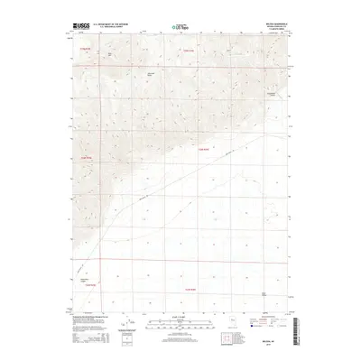
2014 Map of Bolivia
USGS Topo · Published 2014About this map
The Stillwater Range dominates this landscape, rising sharply above the expansive basin of Dixie Valley to the east. This section of Churchill County showcases the stark transition between high-altitude peaks and the floor of the Great Basin. Pine Mtn stands as a prominent landmark in the northwest, while drainage systems like Cottonwood Cr and the steep incisions of Cottonwood Canyon and White Rock Canyon illustrate the erosive forces at work on the range's eastern slopes. The isolation of the area is underscored by the sparse infrastructure, with Dixie Valley Rd serving as the primary corridor through the valley floor. The map provides a detailed view of the township and range system, including sections of t24n r36e and t25n r36e, reflecting the orderly grid of Western land management in this sparsely populated region.
Find a feature on this map
13 named features on this map. Tap any name to fly to it.
Don’t see what you’re looking for? This feature index may not catch every label — zoom into the map to look around manually.
Map Details
Editions of this 2014 Bolivia Map
This is the sole edition of this map. No revisions or reprints were ever made.
Other maps of this area

1908 · Carson Sink
USGS Topo · 1:250,000

1910 · Carson Sink
USGS Topo · 1:250,000

1931 · Lovelock
USGS Topo · 1:250,000

1932 · Sonoma Range
USGS Topo · 1:250,000

1935 · Lovelock
USGS Topo · 1:250,000

1939 · Sonoma Range
USGS Topo · 1:250,000

1954 · Buffalo Mtn
USGS Topo · 1:62,500

1955 · Millett
USGS Topo · 1:250,000

1955 · Lovelock
USGS Topo · 1:250,000

1955 · Winnemucca
USGS Topo · 1:250,000