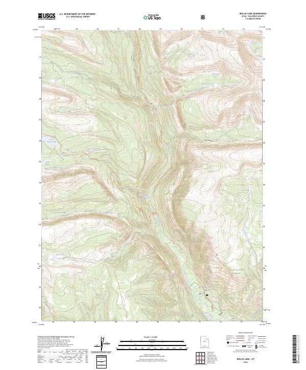
2023 Map of Bollie Lake
USGS Topo · Published 2023About this map
The High Uintas Wilderness provides a dramatic alpine setting for this survey of Duchesne County, characterized by a dense network of glacial lakes and river headwaters. The Uinta River carves a central path through the landscape, flanked by significant water bodies such as Lower Chain Lake, Wild Goose Lake, and the namesake Bollie Lake. These natural reservoirs and the surrounding Ashley National Forest are interconnected by a system of high-altitude paths, including the Uinta River Trl and the Chain Lakes-Atwood Trl.
Find a feature on this map
20 named features on this map. Tap any name to fly to it.
Don’t see what you’re looking for? This feature index may not catch every label — zoom into the map to look around manually.
Map Details
Editions of this 2023 Bollie Lake Map
This is the sole edition of this map. No revisions or reprints were ever made.
Other maps of this area

1885 · Uinta
USGS Topo · 1:250,000

1905 · Gilbert Peak
USGS Topo · 1:125,000

1906 · Gilbert Peak
USGS Topo · 1:125,000

1954 · Salt Lake City
USGS Topo · 1:250,000

1958 · Salt Lake City
USGS Topo · 1:250,000

1960 · Salt Lake City
USGS Topo · 1:250,000
1965 · Rasmussen Lakes
USGS Topo · 1:24,000
1965 · Pole Creek Cave
USGS Topo · 1:24,000

1965 · Mount Emmons
USGS Topo · 1:24,000
1965 · Heller Lake
USGS Topo · 1:24,000