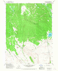
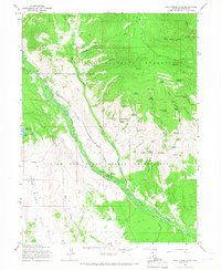
1965 Map of Heller Lake
USGS Topo · Published 1967About this map
Ashley National Forest and the Uintah and Ouray Indian Reservation meet in this high-altitude landscape of Duchesne County. The area is defined by a network of drainage systems including Timothy Creek, Dry Gulch Creek, and Cottonwood Creek, which flow southward from the higher elevations of Jefferson Park. Human activity in the mid-1960s is centered on seasonal land use and water management, evidenced by the Dry Gulch Ranger Station and the Dry Gulch Cattle Camp. The Cedar View Reservoir serves as a significant hydraulic feature near the eastern boundary, while recreational access is highlighted by the U-Bar Ranch Campground and Big Spring Recreation Area. A series of pack trails and jeep trails connect these remote points, traversing landmarks like Washs Nipple and the expansive John Starr Flat.
Find a feature on this map
37 named features on this map. Tap any name to fly to it.
Don’t see what you’re looking for? This feature index may not catch every label — zoom into the map to look around manually.
Map Details
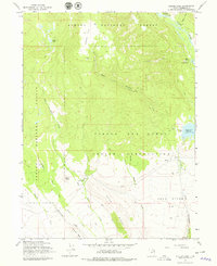
Editions of this 1965 Heller Lake Map
2 editions found
Other maps of this area

1885 · Uinta
USGS Topo · 1:250,000

1905 · Gilbert Peak
USGS Topo · 1:125,000

1906 · Gilbert Peak
USGS Topo · 1:125,000

1939 · Duchesne
USGS Topo · 1:125,000

1954 · Salt Lake City
USGS Topo · 1:250,000

1958 · Salt Lake City
USGS Topo · 1:250,000

1960 · Salt Lake City
USGS Topo · 1:250,000
1965 · Rasmussen Lakes
USGS Topo · 1:24,000
1965 · Neola
USGS Topo · 1:24,000
1965 · Pole Creek Cave
USGS Topo · 1:24,000