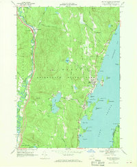
1966 Map of Bolton Landing
USGS Topo · Published 1969About this map
The eastern shore of Lake George and the village of Bolton Landing are central to this mid-1960s study of Warren County's topography. Within the Adirondack State Park, the landscape rises from the developed shoreline at Huddle Bay and Basin Bay toward the interior heights of Cat Mountain and Lamb Hill. This era shows a transition between traditional mountain life and growing tourism, with legacy features like the New Vermont Cem and Federal Hill Cem situated near newer recreation sites like the local Golf Course. To the west, the Schroon River valley defines the boundary, featuring the settlement of Riverbank and the modern footprint of Interchange 24. The map provides detailed coastal views of numerous islands, including Green Island, Crown Island, and Dome Island, reflecting the complex geography of the lake's Northwest Bay.
Find a feature on this map
58 named features on this map. Tap any name to fly to it.
Don’t see what you’re looking for? This feature index may not catch every label — zoom into the map to look around manually.
Map Details
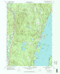
Editions of this 1966 Bolton Landing Map
2 editions found
Other maps of this area

1895 · North Creek
USGS Topo · 1:62,500

1895 · Glens Falls
USGS Topo · 1:62,500

1897 · Bolton
USGS Topo · 1:62,500

1897 · Glens Falls
USGS Topo · 1:62,500

1897 · North Creek
USGS Topo · 1:62,500

1900 · Bolton
USGS Topo · 1:62,500

1903 · Luzerne
USGS Topo · 1:62,500

1938 · Glens Falls
USGS Topo · 1:62,500

1947 · Glens Falls
USGS Topo · 1:62,500

1950 · Glens Falls
USGS Topo · 1:250,000