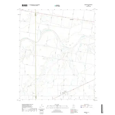
2019 Map of Bomarton
USGS Topo · Published 2019About this map
Bomarton and Red Springs anchor this agricultural and riverine landscape along the boundary of Baylor and Knox Counties. The Brazos River carves a sweeping path across the northern half of the area, fed by a network of drainage systems including Cottonwood Cr, Lake Cr, and Ednas Cr. The terrain is defined by the subtle shift from upland plains to the river breaks, a geography that has dictated the layout of local infrastructure.
Find a feature on this map
51 named features on this map. Tap any name to fly to it.
Don’t see what you’re looking for? This feature index may not catch every label — zoom into the map to look around manually.
Map Details
Editions of this 2019 Bomarton Map
This is the sole edition of this map. No revisions or reprints were ever made.
Other maps of this area

1954 · Wichita Falls
USGS Topo · 1:250,000

1958 · Wichita Falls
USGS Topo · 1:250,000

1962 · Antelope Creek NE
USGS Topo · 1:24,000

1962 · Antelope Creek NW
USGS Topo · 1:24,000

1966 · Seymour West
USGS Topo · 1:24,000

1966 · Soap Creek
USGS Topo · 1:24,000

1966 · Bomarton
USGS Topo · 1:24,000

1966 · Vera
USGS Topo · 1:24,000

1966 · Southwest Lake Kemp
USGS Topo · 1:24,000

1967 · Hefner
USGS Topo · 1:24,000