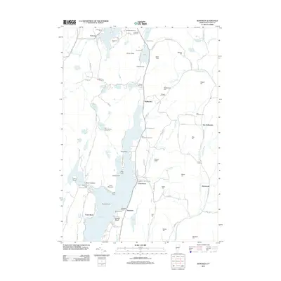
2012 Map of Bomoseen
USGS Topo · Published 2012About this map
Lake Bomoseen dominates this part of Rutland County, its waters punctuated by Neshope Island and complex shorelines like Prospect Point and Mason Point. The landscape is a mix of established lakeside settlements such as Bomoseen and Avalon Beach, and more isolated upland communities including Hortonville and East Hubbardton. Genealogists will find several family burying grounds, such as Bradley Family Cem and Ressegrie Family Cem, tucked among the hills. The terrain is marked by significant ledges and heights, from Barber Ledge in the north to Zion Hill and Eaton Hill in the east. Numerous smaller water bodies like Beebe Pond, Glen Lake, and Lake Hortonia suggest a region shaped by post-glacial topography and long-standing recreational use, evidenced by locations like Half Moon State Park Campground.
Find a feature on this map
118 named features on this map. Tap any name to fly to it.
Don’t see what you’re looking for? This feature index may not catch every label — zoom into the map to look around manually.
Map Details
Editions of this 2012 Bomoseen Map
This is the sole edition of this map. No revisions or reprints were ever made.
Other maps of this area

1893 · Whitehall
USGS Topo · 1:62,500

1894 · Ticonderoga
USGS Topo · 1:62,500

1895 · Whitehall
USGS Topo · 1:62,500

1895 · Castleton
USGS Topo · 1:62,500

1896 · Ticonderoga
USGS Topo · 1:62,500

1897 · Castleton
USGS Topo · 1:62,500

1898 · Whitehall
USGS Topo · 1:62,500

1902 · Whitehall
USGS Topo · 1:62,500

1902 · Ticonderoga
USGS Topo · 1:62,500

1902 · Brandon
USGS Topo · 1:62,500