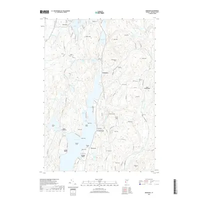
2018 Map of Bomoseen
USGS Topo · Published 2018About this map
Lake Bomoseen and a dense network of smaller glacial water bodies define this portion of Rutland County. The landscape is marked by steep ridges and ledges, such as Barber Ledge and Sargent Hill, which hem in settlements like Hortonia and Hubbardton. The shoreline of the primary lake is dotted with distinct points and landings, including Mason Point and Mortimer Brown Landing.
Find a feature on this map
112 named features on this map. Tap any name to fly to it.
Don’t see what you’re looking for? This feature index may not catch every label — zoom into the map to look around manually.
Map Details
Editions of this 2018 Bomoseen Map
This is the sole edition of this map. No revisions or reprints were ever made.
Other maps of this area

1893 · Whitehall
USGS Topo · 1:62,500

1894 · Ticonderoga
USGS Topo · 1:62,500

1895 · Whitehall
USGS Topo · 1:62,500

1895 · Castleton
USGS Topo · 1:62,500

1896 · Ticonderoga
USGS Topo · 1:62,500

1897 · Castleton
USGS Topo · 1:62,500

1898 · Whitehall
USGS Topo · 1:62,500

1902 · Whitehall
USGS Topo · 1:62,500

1902 · Ticonderoga
USGS Topo · 1:62,500

1902 · Brandon
USGS Topo · 1:62,500