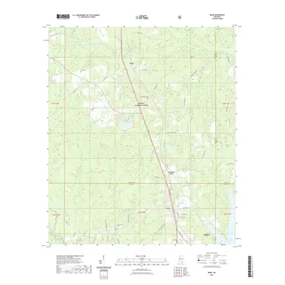
2021 Map of Bond
USGS Topo · Published 2021About this map
The timberlands and rural settlements of De Soto National Forest define this 2021 survey of southern Mississippi. The landscape is marked by the distinct north-south corridor of Route 49, which connects the small communities of Maxie, Fruitland Park, and Bond. This area, sitting at the junction of Forrest, Perry, and Stone counties, is characterized by its network of creeks and small bayous, including Beaverdam Cr, Chaney Creek, and White Pond Cr.
Find a feature on this map
75 named features on this map. Tap any name to fly to it.
Don’t see what you’re looking for? This feature index may not catch every label — zoom into the map to look around manually.
Map Details
Editions of this 2021 Bond Map
This is the sole edition of this map. No revisions or reprints were ever made.
Other maps of this area

1947 · Wiggins
USGS Topo · 1:62,500

1947 · New Augusta
USGS Topo · 1:62,500

1949 · Wiggins
USGS Topo · 1:62,500

1949 · New Augusta
USGS Topo · 1:62,500

1953 · Hattiesburg
USGS Topo · 1:250,000

1953 · Mobile
USGS Topo · 1:250,000

1957 · Mobile
USGS Topo · 1:250,000

1958 · Hattiesburg
USGS Topo · 1:250,000

1958 · Carnes
USGS Topo · 1:62,500

1960 · Mobile
USGS Topo · 1:250,000