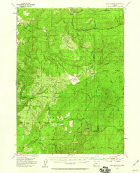
1954 Map of Bone Mountain
USGS Topo · Published 1959About this map
Siskiyou National Forest covers much of this mid-century landscape, where the intersection of Coos, Douglas, and Curry counties creates a complex topographic profile defined by the Middle Fork Coquille River and the Eden Valley River. The presence of a Railroad Grade near Camp No 2 and a Lumber Camp (Site) reflects the heavy industrial reliance on timber extraction during the 1950s. High-altitude outposts like Eden Lookout and the Wooden Rock Guard Sta highlight the critical role of fire watch and forest management in this timber-rich region. Geologic interests are represented by the Fuller Mine and Old Red Mine, located south of Mt Bolivar, indicating the localized prospecting history that accompanied the development of the river valleys. The map documents a network of foot and jeep trails that connected these remote camps and peaks before modern road development was fully established.
Find a feature on this map
60 named features on this map. Tap any name to fly to it.
Don’t see what you’re looking for? This feature index may not catch every label — zoom into the map to look around manually.
Map Details
Editions of this 1954 Bone Mountain Map
2 editions found

Other maps of this area

1896 · Coos Bay
USGS Topo · 1:125,000

1898 · Coos Bay
USGS Topo · 1:125,000

1899 · Port Orford
USGS Topo · 1:125,000

1900 · Coos Bay
USGS Topo · 1:125,000

1903 · Port Orford
USGS Topo · 1:125,000

1928 · Sitkum
USGS Topo · 1:125,000

1942 · Coquille
USGS Topo · 1:62,500

1945 · Coquille
USGS Topo · 1:62,500

1946 · Galice
USGS Topo · 1:62,500

1946 · Dutchman Butte
USGS Topo · 1:62,500