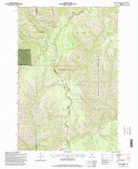
1995 Map of Bone Spring
USGS Topo · Published 1998About this map
Umatilla National Forest and the Wenaha Tucannon Wilderness define this high-altitude landscape along the border of Wallowa and Umatilla counties. The topography is dominated by the steep drainage basins of the South Fork Walla Walla River and the South Fork Wenaha River, which flow from high ridges like Broken Ridge and Paradise Ridge. This map captures a remote area of the Blue Mountains where water sources are vital, documented by numerous named points such as Bone Spring, Husky Spring, and Squaw Spring.
Find a feature on this map
30 named features on this map. Tap any name to fly to it.
Don’t see what you’re looking for? This feature index may not catch every label — zoom into the map to look around manually.
Map Details
Editions of this 1995 Bone Spring Map
This is the sole edition of this map. No revisions or reprints were ever made.
Other maps of this area

1919 · Walla Walla
USGS Topo · 1:125,000

1921 · Walla Walla
USGS Topo · 1:125,000

1937 · Pomeroy
USGS Topo · 1:96,000

1942 · Pomeroy
USGS Topo · 1:125,000

1953 · Pendleton
USGS Topo · 1:250,000

1953 · Walla Walla
USGS Topo · 1:250,000

1955 · Pullman
USGS Topo · 1:250,000

1955 · Grangeville
USGS Topo · 1:250,000

1956 · Pendleton
USGS Topo · 1:250,000

1958 · Pullman
USGS Topo · 1:250,000