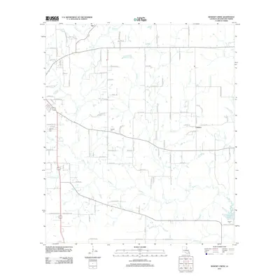
2012 Map of Boneset Creek
USGS Topo · Published 2012About this map
Longacre and Ikes anchor this section of Louisiana’s piney woods, where a complex network of waterways defines the parish landscape. The map centers on the winding course of Bundick Cr, which eventually feeds into the expansive Bundick Lake in the southeast corner. The terrain is notably dissected by numerous named branches and creeks, including Boneset Cr, Brushy Cr, and the descriptive Turkey Hollow Cr. This drainage pattern suggests the low-lying, often marshy conditions characteristic of the region’s timber and ranching country.
Find a feature on this map
111 named features on this map. Tap any name to fly to it.
Don’t see what you’re looking for? This feature index may not catch every label — zoom into the map to look around manually.
Map Details
Editions of this 2012 Boneset Creek Map
This is the sole edition of this map. No revisions or reprints were ever made.
Other maps of this area

1947 · DeRidder
USGS Topo · 1:31,680

1947 · Rosepine
USGS Topo · 1:31,680

1947 · Ikes
USGS Topo · 1:31,680

1947 · Chasmore
USGS Topo · 1:31,680

1947 · Bundick
USGS Topo · 1:31,680

1947 · Beckwith School
USGS Topo · 1:31,680

1947 · Sugartown
USGS Topo · 1:31,680

1947 · Bannister
USGS Topo · 1:31,680

1947 · Sugrue
USGS Topo · 1:31,680
1950 · Dry Creek
USGS Topo · 1:24,000