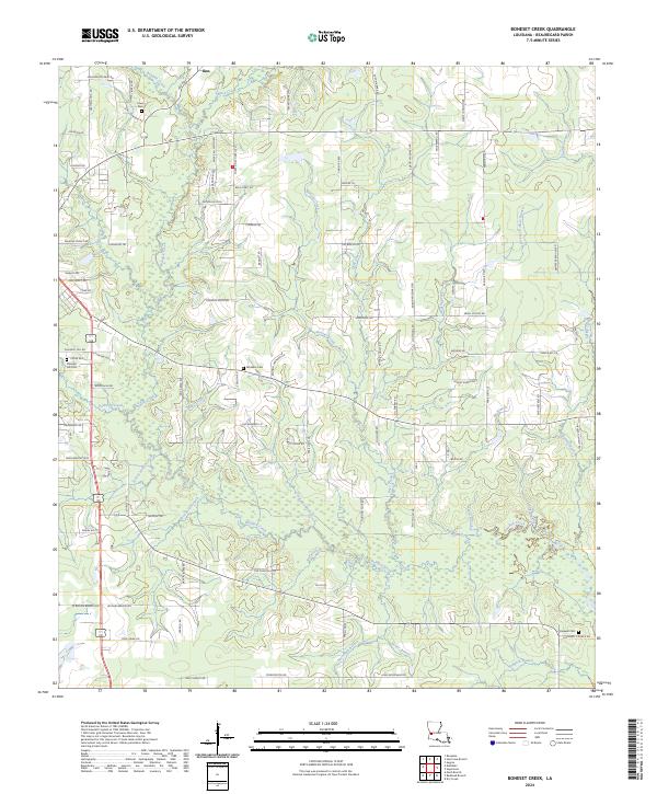
2024 Map of Boneset Creek
USGS Topo · Published 2024About this map
Bundick Creek and its many tributaries, including Palmetto Creek and Woodard Branch, weave through this section of Beauregard Parish. The landscape is defined by its water systems and rural road networks, with the small settlement of Ikes situated in the northern reaches near Black Creek. To the east, residential growth is evident in the Shirley Subdivision, while the rest of the quadrangle maintains a low-density character marked by family-named roads like Tommy Lindsey Rd and Dwayne Cooley Rd.
Find a feature on this map
105 named features on this map. Tap any name to fly to it.
Don’t see what you’re looking for? This feature index may not catch every label — zoom into the map to look around manually.
Map Details
Editions of this 2024 Boneset Creek Map
This is the sole edition of this map. No revisions or reprints were ever made.
Other maps of this area

1947 · DeRidder
USGS Topo · 1:31,680

1947 · Rosepine
USGS Topo · 1:31,680

1947 · Ikes
USGS Topo · 1:31,680

1947 · Chasmore
USGS Topo · 1:31,680

1947 · Bundick
USGS Topo · 1:31,680

1947 · Beckwith School
USGS Topo · 1:31,680

1947 · Sugartown
USGS Topo · 1:31,680

1947 · Bannister
USGS Topo · 1:31,680

1947 · Sugrue
USGS Topo · 1:31,680
1950 · Dry Creek
USGS Topo · 1:24,000