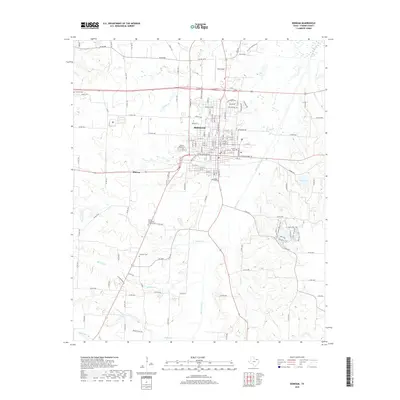
2019 Map of Bonham
USGS Topo · Published 2019About this map
Bonham serves as the focal point of this North Texas survey, where a well-established grid of residential streets and schools sits at the intersection of several major regional thoroughfares including Us 82 and W Sam Rayburn Dr. The town's historical depth is evident in the numerous burial grounds surrounding the center, from the large Willow Wild Cem and the central Inglish Cem to the outlying Hampton Cem and Gates Hill Cem.
Find a feature on this map
135 named features on this map. Tap any name to fly to it.
Don’t see what you’re looking for? This feature index may not catch every label — zoom into the map to look around manually.
Map Details
Editions of this 2019 Bonham Map
This is the sole edition of this map. No revisions or reprints were ever made.
Other maps of this area

1954 · Sherman
USGS Topo · 1:250,000

1958 · Bonham
USGS Topo · 1:62,500

1958 · Whitesright
USGS Topo · 1:62,500

1958 · Sherman
USGS Topo · 1:250,000

1964 · Trenton
USGS Topo · 1:24,000
1964 · Gober
USGS Topo · 1:24,000
1964 · Leonard
USGS Topo · 1:24,000
1984 · Lamasco
USGS Topo · 1:24,000
1984 · Dodd City
USGS Topo · 1:24,000
1984 · Lake Bonham
USGS Topo · 1:24,000