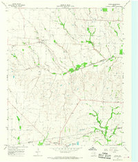
1964 Map of Gober
USGS Topo · Published 1968About this map
The North Sulphur River and Middle Sulphur River systems define this rural landscape on the border of Fannin and Hunt Counties. Small farming communities such as Gober and Silver City are connected by a network of local roads and sections of the Atchison Topeka and Santa Fe railroad, which skirts the southern edge near Wolfe City. This mid-century survey captures the region's agricultural character, dotted with numerous family and community burial grounds including Rehobeth Cem and Woods Cem. The presence of several quarries and a Gravel Pit near Gober indicates local extraction industries that operated alongside the river bottoms. Specialized landmarks like the Henington Landing Strip and the Radio Tower near Center Point Cem provide specific points of interest for local historians and genealogists tracing 1960s rural development.
Find a feature on this map
35 named features on this map. Tap any name to fly to it.
Don’t see what you’re looking for? This feature index may not catch every label — zoom into the map to look around manually.
Map Details
Editions of this 1964 Gober Map
This is the sole edition of this map. No revisions or reprints were ever made.
Other maps of this area

1903 · Paris
USGS Topo · 1:125,000

1947 · Honey Grove
USGS Topo · 1:62,500

1949 · Honey Grove
USGS Topo · 1:62,500

1953 · Texarkana
USGS Topo · 1:250,000

1954 · Sherman
USGS Topo · 1:250,000

1956 · Texarkana
USGS Topo · 1:250,000

1958 · Bonham
USGS Topo · 1:62,500

1958 · Sherman
USGS Topo · 1:250,000

1964 · Commerce North
USGS Topo · 1:24,000

1964 · Celeste
USGS Topo · 1:24,000