2022 Map of Bonham
USGS Topo · Published 2022About this map
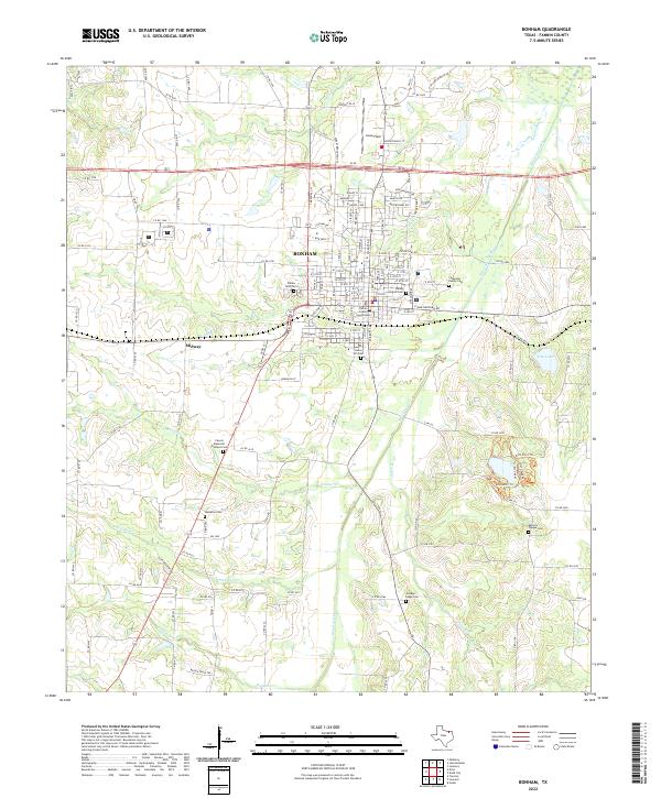
Bonham serves as the focal point of this North Texas survey, centered on the Fannin County Courthouse and a dense network of local streets. The landscape is deeply tied to its pioneer heritage, evidenced by the numerous burial grounds surrounding the town, including Willow Wild Cem, Bailey Inglish Cem, and Gates Hill Cem. Beyond the residential core, the map reveals an extensive watershed dominated by Bois d'Arc Creek and its many tributaries like Timber Cr and Cooper Cr. To the southeast, City Lake provides a significant water feature near State Park 24, where local trails such as the Armadillo Trl wind through the terrain. The presence of Jones Field to the north and the settlement of Midway to the southwest illustrate the area's ongoing development and role as a regional hub.
Find a feature on this map
149 named features on this map. Tap any name to fly to it.
Don’t see what you’re looking for? This feature index may not catch every label — zoom into the map to look around manually.
Map Details
Editions of this 2022 Bonham Map
This is the sole edition of this map. No revisions or reprints were ever made.