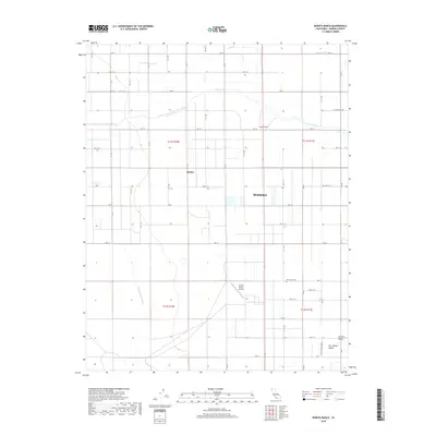
2018 Map of Bonita Ranch
USGS Topo · Published 2018About this map
Bonita Ranch and the neighboring settlement of Bonita anchor this portion of the San Joaquin Valley, a landscape defined by an extensive grid of agricultural roads and irrigation infrastructure. The map reveals the critical role of water management in Madera County, tracing the Fresno River and its various offshoots including Airport Ditch and the Gravelly Ford Canal. The regularity of the terrain is punctuated by localized hubs of activity, such as the El Peco Ranch Airport and the New Hope Cem located near the intersection of Ave 11. This 2018 survey captures the region's structured rural character, from the small clusters of buildings at Central Valley to the namesake ranching operations. The detailed network of avenues, ranging from Ave 17 down to Ave 9, illustrates the systematic organization of this fertile valley floor.
Find a feature on this map
32 named features on this map. Tap any name to fly to it.
Don’t see what you’re looking for? This feature index may not catch every label — zoom into the map to look around manually.
Map Details
Editions of this 2018 Bonita Ranch Map
This is the sole edition of this map. No revisions or reprints were ever made.
Other maps of this area

1916 · Berenda
USGS Topo · 1:31,680

1918 · Chowchilla
USGS Topo · 1:31,680

1918 · Berenda
USGS Topo · 1:31,680

1920 · Kismet
USGS Topo · 1:31,680

1920 · Bonita Ranch
USGS Topo · 1:31,680

1921 · Mendota
USGS Topo · 1:31,680

1921 · Bonita Ranch
USGS Topo · 1:31,680

1922 · Kentucky Well
USGS Topo · 1:31,680

1922 · Madera
USGS Topo · 1:31,680

1923 · Biola
USGS Topo · 1:31,680