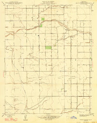
1947 Map of Bonita Ranch
USGS Topo · Published 1947About this map
Agricultural development in the San Joaquin Valley is well-established by the late 1940s, as shown in this survey of Madera County. Large landholdings like Bonita Ranch and El Peco Ranch dominate the landscape, situated near the meandering course of the Fresno River. The infrastructure for water management is a central theme of this sheet, marked by the presence of numerous windmills across the plains and the trace of the Gravelly Ford Canal (Abandoned). The transition from early 20th-century irrigation attempts to more modern water control is evident here, with natural watercourses like Dry Creek and Cottonwood Creek cutting through a strictly gridded system of section lines and early thoroughfares such as Firebaugh Road. This record captures the region just before the post-war boom further intensified the Central Valley's industrial agriculture.
Find a feature on this map
9 named features on this map. Tap any name to fly to it.
Don’t see what you’re looking for? This feature index may not catch every label — zoom into the map to look around manually.
Map Details
Editions of this 1947 Bonita Ranch Map
This is the sole edition of this map. No revisions or reprints were ever made.
Other maps of this area

1916 · Berenda
USGS Topo · 1:31,680

1918 · Chowchilla
USGS Topo · 1:31,680

1918 · Berenda
USGS Topo · 1:31,680

1920 · Kismet
USGS Topo · 1:31,680

1920 · Bonita Ranch
USGS Topo · 1:31,680

1921 · Mendota
USGS Topo · 1:31,680

1921 · Bonita Ranch
USGS Topo · 1:31,680

1922 · Kentucky Well
USGS Topo · 1:31,680

1922 · Madera
USGS Topo · 1:31,680

1923 · Biola
USGS Topo · 1:31,680