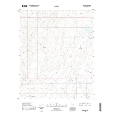
2018 Map of Bonito Rock
USGS Topo · Published 2018About this map
Bonito Rock stands as a prominent landmark in this high-elevation corner of Apache County, where the landscape is defined by an intricate network of creeks and high-altitude wetlands known as cienegas. The area is a vital watershed, draining through Big Bonito Cr, Pacheta Cr, and Reservation Cr. Several alpine bodies of water, including Hurricane Lake and Reservation Lake, are situated among the peaks of Burnt Mtn and Aspen Butte. The drainage patterns suggest a complex topography of ridges and basins, with features like Deep Cienega and Race Horse Cienega indicating areas of persistent moisture amidst the volcanic terrain. Access through this region is limited to remote routes like Co RD 8, reflecting its character as a wilderness area focused on natural hydrology and timbered highlands.
Find a feature on this map
36 named features on this map. Tap any name to fly to it.
Don’t see what you’re looking for? This feature index may not catch every label — zoom into the map to look around manually.
Map Details
Editions of this 2018 Bonito Rock Map
This is the sole edition of this map. No revisions or reprints were ever made.
Other maps of this area

1922 · Nutrioso
USGS Topo · 1:125,000

1954 · Clifton
USGS Topo · 1:250,000

1957 · Clifton
USGS Topo · 1:250,000

1958 · Clifton
USGS Topo · 1:250,000

1958 · Hannagan Meadow
USGS Topo · 1:62,500

1958 · Big Lake
USGS Topo · 1:62,500

1962 · Clifton
USGS Topo · 1:250,000

1967 · Marshall Butte
USGS Topo · 1:24,000
1967 · Bonito Rock
USGS Topo · 1:24,000

1967 · Odart Mtn
USGS Topo · 1:24,000