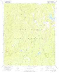
1978 Map of Bonito Rock
USGS Topo · Published 1978About this map
The Fort Apache Indian Reservation landscape is defined by its network of high-elevation creeks and cienegas, captured here in a 1978 edition revised by the Bureau of Indian Affairs. This mountainous terrain features several notable water bodies, including Reservation Lake and the smaller Pucheta Lake, which serves as a center for activity with a designated Campground nearby. The map documents the presence of Duke Ranch and Reservation Ranch, providing a window into the ranching operations managed within the reservation boundaries during this era.
Find a feature on this map
35 named features on this map. Tap any name to fly to it.
Don’t see what you’re looking for? This feature index may not catch every label — zoom into the map to look around manually.
Map Details
Editions of this 1978 Bonito Rock Map
This is the sole edition of this map. No revisions or reprints were ever made.
Other maps of this area

1922 · Nutrioso
USGS Topo · 1:125,000

1954 · Clifton
USGS Topo · 1:250,000

1957 · Clifton
USGS Topo · 1:250,000

1958 · Clifton
USGS Topo · 1:250,000

1958 · Hannagan Meadow
USGS Topo · 1:62,500

1958 · Big Lake
USGS Topo · 1:62,500

1962 · Clifton
USGS Topo · 1:250,000

1967 · Marshall Butte
USGS Topo · 1:24,000
1967 · Bonito Rock
USGS Topo · 1:24,000

1967 · Odart Mtn
USGS Topo · 1:24,000