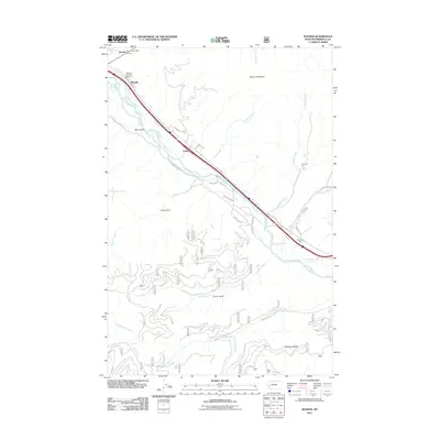
2011 Map of Bonner
USGS Topo · Published 2011About this map
The confluence of the Blackfoot River and Clark Fork dominates this study of the canyon landscape east of Missoula. The settlement pattern follows the narrow valley floor, with Bonner and the Bonner Post Office serving as a focal point for the region's historical timber and transport industry. Movement through the corridor is defined by the heavy infrastructure of the river-level rail lines and the winding path of Old US Hwy 10, which connects the smaller communities of Piltzville and Turah.
Find a feature on this map
39 named features on this map. Tap any name to fly to it.
Don’t see what you’re looking for? This feature index may not catch every label — zoom into the map to look around manually.
Map Details
Editions of this 2011 Bonner Map
This is the sole edition of this map. No revisions or reprints were ever made.
Other maps of this area

1903 · Bonner
USGS Topo · 1:125,000

1947 · Butte
USGS Topo · 1:250,000

1958 · Butte
USGS Topo · 1:250,000

1959 · Cleveland Mountain
USGS Topo · 1:62,500

1959 · Ravenna
USGS Topo · 1:62,500

1960 · Butte
USGS Topo · 1:250,000

1962 · Butte
USGS Topo · 1:250,000
1964 · Southeast Missoula
USGS Topo · 1:24,000

1964 · Northeast Missoula
USGS Topo · 1:24,000
1965 · Sunflower Mountain
USGS Topo · 1:24,000