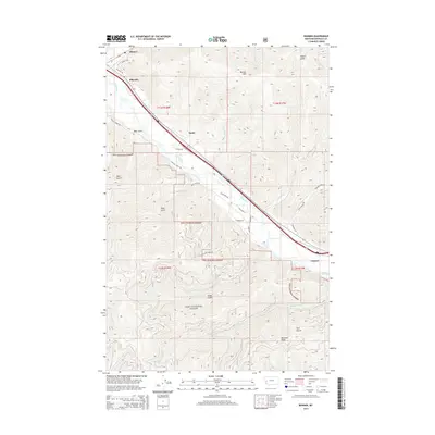
2014 Map of Bonner
USGS Topo · Published 2014About this map
The Clark Fork river valley serves as the primary corridor for human activity and transport in this part of Missoula County, cutting through the high country of the Lolo National Forest. The map documents a sequence of valley settlements including Bonner, Piltzville, Turah, and Clinton, all situated along the river and major transit lines. This geography dictates a concentrated pattern of development on the narrow valley floor, contrasted sharply by the steep, drainage-cut slopes of Bonner Mtn and Moccasin Ridge.
Find a feature on this map
40 named features on this map. Tap any name to fly to it.
Don’t see what you’re looking for? This feature index may not catch every label — zoom into the map to look around manually.
Map Details
Editions of this 2014 Bonner Map
This is the sole edition of this map. No revisions or reprints were ever made.
Other maps of this area

1903 · Bonner
USGS Topo · 1:125,000

1947 · Butte
USGS Topo · 1:250,000

1958 · Butte
USGS Topo · 1:250,000

1959 · Cleveland Mountain
USGS Topo · 1:62,500

1959 · Ravenna
USGS Topo · 1:62,500

1960 · Butte
USGS Topo · 1:250,000

1962 · Butte
USGS Topo · 1:250,000
1964 · Southeast Missoula
USGS Topo · 1:24,000

1964 · Northeast Missoula
USGS Topo · 1:24,000
1965 · Sunflower Mountain
USGS Topo · 1:24,000