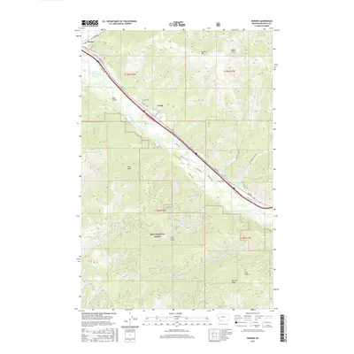
2017 Map of Bonner
USGS Topo · Published 2017About this map
The Clark Fork river valley serves as the primary corridor for movement and settlement in this portion of Missoula County. The community of Bonner is situated at the northwestern corner of the map where the river bends sharply, while Turah lies further east along the valley floor. Transportation is defined by Fas 210 and several local routes like Turah Rd and Crystal Creek Rd that navigate the narrow habitable land between the water and the rising slopes of Bonner Mtn.
Find a feature on this map
43 named features on this map. Tap any name to fly to it.
Don’t see what you’re looking for? This feature index may not catch every label — zoom into the map to look around manually.
Map Details
Editions of this 2017 Bonner Map
This is the sole edition of this map. No revisions or reprints were ever made.
Other maps of this area

1903 · Bonner
USGS Topo · 1:125,000

1947 · Butte
USGS Topo · 1:250,000

1958 · Butte
USGS Topo · 1:250,000

1959 · Cleveland Mountain
USGS Topo · 1:62,500

1959 · Ravenna
USGS Topo · 1:62,500

1960 · Butte
USGS Topo · 1:250,000

1962 · Butte
USGS Topo · 1:250,000
1964 · Southeast Missoula
USGS Topo · 1:24,000

1964 · Northeast Missoula
USGS Topo · 1:24,000
1965 · Sunflower Mountain
USGS Topo · 1:24,000