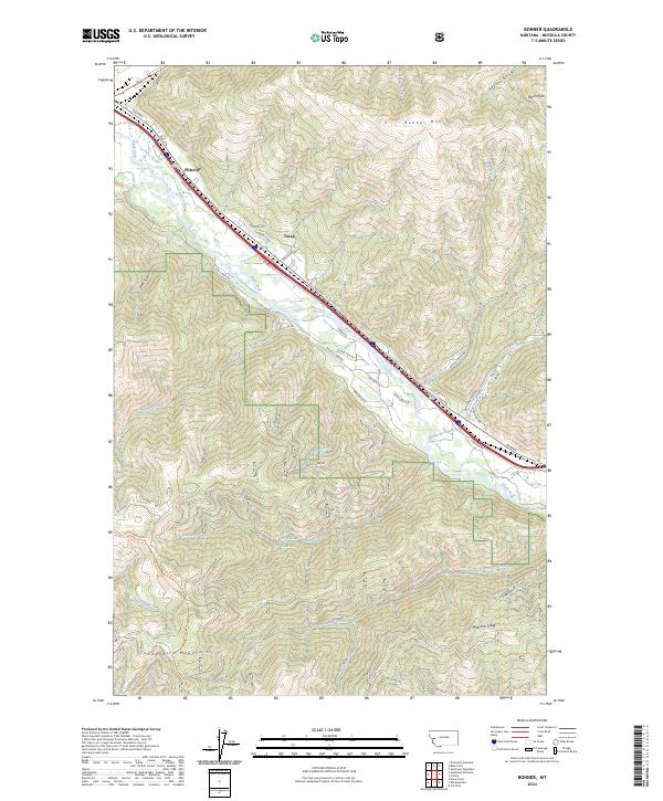
2024 Map of Bonner
USGS Topo · Published 2024About this map
Clark Fork winds through a narrow canyon floor, serving as the primary corridor for regional transit and settlement. The small communities of Piltzville and Turah are concentrated along the riverbanks, where the topography levels out before ascending sharply into the high country. This modern topographic study reveals a landscape defined by dramatic vertical relief, from the heights of Bonner Mtn and Olson Peak to the drainages of Crystal Creek and Donovan Creek.
Find a feature on this map
47 named features on this map. Tap any name to fly to it.
Don’t see what you’re looking for? This feature index may not catch every label — zoom into the map to look around manually.
Map Details
Editions of this 2024 Bonner Map
This is the sole edition of this map. No revisions or reprints were ever made.
Other maps of this area

1903 · Bonner
USGS Topo · 1:125,000

1947 · Butte
USGS Topo · 1:250,000

1958 · Butte
USGS Topo · 1:250,000

1959 · Cleveland Mountain
USGS Topo · 1:62,500

1959 · Ravenna
USGS Topo · 1:62,500

1960 · Butte
USGS Topo · 1:250,000

1962 · Butte
USGS Topo · 1:250,000
1964 · Southeast Missoula
USGS Topo · 1:24,000

1964 · Northeast Missoula
USGS Topo · 1:24,000
1965 · Sunflower Mountain
USGS Topo · 1:24,000