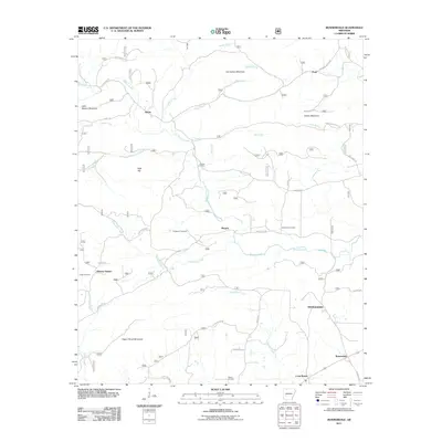
2011 Map of Bonnerdale
USGS Topo · Published 2011About this map
Mazarn Creek and its many tributaries, such as Tea Creek and Waterfork Creek, define the drainage of this central Arkansas landscape. The area is characterized by several distinct ridges and summits, including Pigeon Roost Mountain, Kinsey Mountain, and Horseshoe Mountain, which frame the small communities settled along the valley floors. In the early 21st century, the map shows a network of rural settlements like Alamo, Mazarn, and Bonnerdale, connected by local routes such as Pigeon Roost Rd and Caddo Gap Rd. Genealogy researchers can find several established burial grounds, including the Howton Cemetery and Wacaster Cemetery, located near these historic centers. The distinction between Old Bonnerdale and the contemporary Bonnerdale settlement provides a clear record of the community's geographic shift over time, while landmarks like Hickory Station and Wyatt Spring offer further points of interest for local history studies.
Find a feature on this map
48 named features on this map. Tap any name to fly to it.
Don’t see what you’re looking for? This feature index may not catch every label — zoom into the map to look around manually.
Map Details
Editions of this 2011 Bonnerdale Map
This is the sole edition of this map. No revisions or reprints were ever made.
Other maps of this area

1890 · Mount Ida
USGS Topo · 1:125,000

1890 · Hot Springs
USGS Topo · 1:125,000

1894 · Hot Springs
USGS Topo · 1:125,000

1906 · Caddo Gap
USGS Topo · 1:125,000

1936 · Glenwood
USGS Topo · 1:48,000

1942 · Glenwood
USGS Topo · 1:62,500

1949 · Glenwood
USGS Topo · 1:62,500

1955 · Little Rock
USGS Topo · 1:250,000

1956 · Little Rock
USGS Topo · 1:250,000

1959 · Mount Ida
USGS Topo · 1:62,500