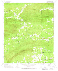
1966 Map of Bonnerdale
USGS Topo · Published 1967About this map
Pigeon Roost Mountain and Horseshoe Mountain dominate this mid-century landscape in the Ouachita National Forest, where the transition from higher terrain to the valley floor is marked by an extensive Old Railroad Grade. This decommissioned line, along with the Pipeline cutting through the southern half of the sheet, reveals the industrial footprint left by timber and energy infrastructure in the Ouachita foothills. Settlement is focused around Alamo and the dual locations of Old Bonnerdale and Bonnerdale, where small cemeteries like Wacaster Cem and Howerton Cem preserve the names of early resident families. The mapping of Wyatt Spring and various creek systems, including Mazarn Creek and Cold Water Creek, highlights the critical importance of water sources in this wooded portion of the Montgomery and Garland County borders.
Find a feature on this map
39 named features on this map. Tap any name to fly to it.
Don’t see what you’re looking for? This feature index may not catch every label — zoom into the map to look around manually.
Map Details
Editions of this 1966 Bonnerdale Map
This is the sole edition of this map. No revisions or reprints were ever made.
Other maps of this area

1890 · Mount Ida
USGS Topo · 1:125,000

1890 · Hot Springs
USGS Topo · 1:125,000

1894 · Hot Springs
USGS Topo · 1:125,000

1906 · Caddo Gap
USGS Topo · 1:125,000

1936 · Glenwood
USGS Topo · 1:48,000

1942 · Glenwood
USGS Topo · 1:62,500

1949 · Glenwood
USGS Topo · 1:62,500

1955 · Little Rock
USGS Topo · 1:250,000

1956 · Little Rock
USGS Topo · 1:250,000

1959 · Mount Ida
USGS Topo · 1:62,500