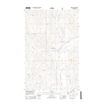
2014 Map of Bonnet Top
USGS Topo · Published 2014About this map
Kootenai National Forest dominates this section of Lincoln County, where the topography is defined by the high ridges of the Purcell Mountains. The drainage system is anchored by the Yaak River and its major tributary, the W Fork Yaak River, which winds through the western half of the map past landmarks like Upper Falls and Lower Falls. The map documents a wilderness landscape managed for timber and conservation, crisscrossed by specialized infrastructure such as Natl Forest Develop Road 757 Rd and the W Side Yaak River Rd. Local peaks like Bonnet Top and Dusty Peak overlook a network of seasonal drainages including Boyd Cr and Koo Koo Cr. To the southeast, Hoskins Lake sits in the shadow of steep slopes, marking one of the few standing water bodies in this heavily forested terrain.
Find a feature on this map
35 named features on this map. Tap any name to fly to it.
Don’t see what you’re looking for? This feature index may not catch every label — zoom into the map to look around manually.
Map Details
Editions of this 2014 Bonnet Top Map
This is the sole edition of this map. No revisions or reprints were ever made.
Other maps of this area

1957 · Kalispell
USGS Topo · 1:250,000

1960 · Kalispell
USGS Topo · 1:250,000

1961 · Kalispell
USGS Topo · 1:250,000

1963 · Yaak
USGS Topo · 1:24,000

1963 · Garver Mountain
USGS Topo · 1:24,000

1963 · Clark Mountain
USGS Topo · 1:24,000

1963 · Bonnet Top
USGS Topo · 1:24,000

1963 · Mount Henry
USGS Topo · 1:24,000

1963 · Lost Horse Mountain
USGS Topo · 1:24,000

1979 · Yaak River
USGS Topo · 1:100,000