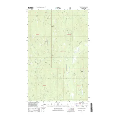
2017 Map of Bonnet Top
USGS Topo · Published 2017About this map
Yaak serves as the central hub of this remote corner of the Kootenai National Forest in northwest Montana. The landscape is defined by the steep drainage of the Yaak River and its tributaries, including the West Fork Yaak River and French Creek. Notable topographic landmarks like Bonnet Top, Lick Mtn, and Dusty Peak rise above the river valley, marking the heights of the Purcell Mountains. The river’s descent through the terrain is punctuated by Upper Falls and Lower Falls, providing specific points of interest for those studying the hydrology of the Yaak Valley.
Find a feature on this map
41 named features on this map. Tap any name to fly to it.
Don’t see what you’re looking for? This feature index may not catch every label — zoom into the map to look around manually.
Map Details
Editions of this 2017 Bonnet Top Map
This is the sole edition of this map. No revisions or reprints were ever made.
Other maps of this area

1957 · Kalispell
USGS Topo · 1:250,000

1960 · Kalispell
USGS Topo · 1:250,000

1961 · Kalispell
USGS Topo · 1:250,000

1963 · Yaak
USGS Topo · 1:24,000

1963 · Garver Mountain
USGS Topo · 1:24,000

1963 · Clark Mountain
USGS Topo · 1:24,000

1963 · Bonnet Top
USGS Topo · 1:24,000

1963 · Mount Henry
USGS Topo · 1:24,000

1963 · Lost Horse Mountain
USGS Topo · 1:24,000

1979 · Yaak River
USGS Topo · 1:100,000