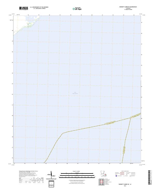
2024 Map of Bonnett Carre NE
USGS Topo · Published 2024About this map
Lake Pontchartrain dominates this coastal Louisiana landscape, representing a vast stretch of open water where the boundaries of several parishes converge. The sheet illustrates the watery intersection of St. John the Baptist Parish and Jefferson Parish, alongside the line for St. Charles Parish. Because this area is primarily open water or sensitive wetlands, the map lacks traditional topographic contours, focusing instead on the precise administrative demarcations that define regional governance across the basin. The sparse nature of the labels reflects the transition from the mainland into the brackish environment of the lake, an area vital to the coastal geography of southeastern Louisiana.
Find a feature on this map
4 named features on this map. Tap any name to fly to it.
Don’t see what you’re looking for? This feature index may not catch every label — zoom into the map to look around manually.
Map Details
Editions of this 2024 Bonnett Carre NE Map
This is the sole edition of this map. No revisions or reprints were ever made.
Other maps of this area

1891 · Spanish Fort
USGS Topo · 1:62,500

1892 · Bonnet Carre
USGS Topo · 1:62,500

1935 · Laplace
USGS Topo · 1:31,680

1935 · Covington
USGS Topo · 1:62,500

1935 · Ponchatoula
USGS Topo · 1:62,500

1936 · Ruddock
USGS Topo · 1:31,680

1936 · Bonnet Carre
USGS Topo · 1:62,500

1936 · Spanish Fort
USGS Topo · 1:62,500
1938 · La Branche
USGS Topo · 1:31,680
1938 · Indian Beach
USGS Topo · 1:31,680