2024 Map of Bono
USGS Topo · Published 2024About this map
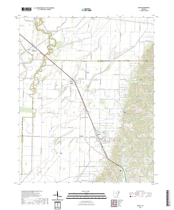
Crowleys Ridge rises above the alluvial lowlands of Craighead County, providing a distinct topographical contrast to the surrounding drainage networks of the Cache River and West Cache River Slough. The town of Bono serves as a central hub, situated along the BNSF Railway corridor that also connects smaller locales such as Pauls Switch and Dorothy. This transit-oriented layout reflects the agricultural and industrial development patterns typical of Northeast Arkansas, where rail lines and ditches like Gum Slough Ditch dictated the location of settlements and property boundaries.
Find a feature on this map
124 named features on this map. Tap any name to fly to it.
Don’t see what you’re looking for? This feature index may not catch every label — zoom into the map to look around manually.
Map Details
Editions of this 2024 Bono Map
This is the sole edition of this map. No revisions or reprints were ever made.