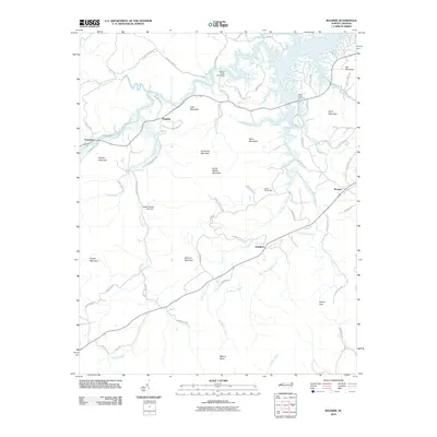
2010 Map of Boomer
USGS Topo · Published 2010About this map
The Yadkin River and its northern tributaries define this landscape, winding through a complex of peaks and ridges including Stoneman Mountain and Mars Mountain. In the early 21st century, the northern portion of the quadrangle shows the recreational development around the river, highlighted by the Warrior Creek Boat Ramp and the Blood Creek Overlook. The terrain is marked by family-named roads and landmarks, reflecting the deep-rooted local history of communities like Boomer and Ferguson.
Find a feature on this map
63 named features on this map. Tap any name to fly to it.
Don’t see what you’re looking for? This feature index may not catch every label — zoom into the map to look around manually.
Map Details
Editions of this 2010 Boomer Map
This is the sole edition of this map. No revisions or reprints were ever made.
Other maps of this area

1889 · Wilkesboro
USGS Topo · 1:125,000

1891 · Wilkesboro
USGS Topo · 1:125,000

1895 · Hickory
USGS Topo · 1:125,000

1953 · Charlotte
USGS Topo · 1:250,000

1953 · Winston-Salem
USGS Topo · 1:250,000

1954 · Charlotte
USGS Topo · 1:250,000

1955 · Winston-Salem
USGS Topo · 1:250,000

1960 · Charlotte
USGS Topo · 1:250,000

1962 · Winston-Salem
USGS Topo · 1:250,000

1962 · Charlotte
USGS Topo · 1:250,000