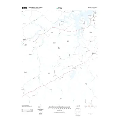
2013 Map of Boomer
USGS Topo · Published 2013About this map
The Yadkin River flows eastward across the northern portion of this Wilkes County landscape, forming the sprawling finger-like inlets of the W Kerr Scott Reservoir. This 2013 survey illustrates the rugged Appalachian foothills where small settlements like Oakdale and Ferguson are connected by roads that wind through a series of named peaks, including Stoneman Mountain and Smith Walker Mountain. The settlement of Thankful sits along the southern highway corridor, situated between the drainages of Little Warrior Cr and Big Warrior Cr. Notable recreational and scenic points such as the Warrior Creek Boat Ramp and the Blood Creek Overlook reflect the area's importance for public access to the reservoir's shoreline. Further south, the terrain rises toward Walnut Knob and the geographic pass at Boone Gap, marking the transition into the higher elevations of the Blue Ridge system.
Find a feature on this map
97 named features on this map. Tap any name to fly to it.
Don’t see what you’re looking for? This feature index may not catch every label — zoom into the map to look around manually.
Map Details
Editions of this 2013 Boomer Map
This is the sole edition of this map. No revisions or reprints were ever made.
Other maps of this area

1889 · Wilkesboro
USGS Topo · 1:125,000

1891 · Wilkesboro
USGS Topo · 1:125,000

1895 · Hickory
USGS Topo · 1:125,000

1953 · Charlotte
USGS Topo · 1:250,000

1953 · Winston-Salem
USGS Topo · 1:250,000

1954 · Charlotte
USGS Topo · 1:250,000

1955 · Winston-Salem
USGS Topo · 1:250,000

1960 · Charlotte
USGS Topo · 1:250,000

1962 · Winston-Salem
USGS Topo · 1:250,000

1962 · Charlotte
USGS Topo · 1:250,000