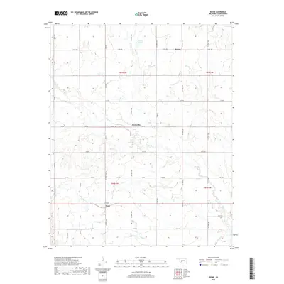
2018 Map of Boone
USGS Topo · Published 2018About this map
Boone and the small settlements of Broxton and Hatchetville anchor this Caddo County landscape, which is defined by a dendritic network of drainage creeks. The terrain is characterized by the branching paths of E Cache Cr, Tahoe Cr, and Mission Cr, all flowing generally eastward toward East Cache Creek. These watercourses create a distinct topographic texture across the plains, influencing the placement of the rural road grid, including Co RD 1400 and e1470 RD.
Find a feature on this map
42 named features on this map. Tap any name to fly to it.
Don’t see what you’re looking for? This feature index may not catch every label — zoom into the map to look around manually.
Map Details
Editions of this 2018 Boone Map
This is the sole edition of this map. No revisions or reprints were ever made.
Other maps of this area

1949 · Elgin
USGS Topo · 1:24,000

1950 · Saddle Mountain
USGS Topo · 1:62,500

1951 · Fort Cobb
USGS Topo · 1:62,500

1955 · Lawton
USGS Topo · 1:250,000

1955 · Clinton
USGS Topo · 1:250,000

1956 · Alden
USGS Topo · 1:24,000

1956 · Boone
USGS Topo · 1:24,000

1956 · Elgin
USGS Topo · 1:24,000

1956 · Richards Spur
USGS Topo · 1:24,000

1956 · Meers
USGS Topo · 1:24,000