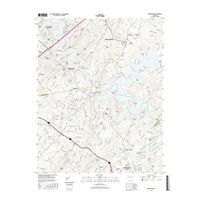
2016 Map of Boone Dam
USGS Topo · Published 2016About this map
Boone Lake and Fort Patrick Henry Lake dominate this landscape on the border of Sullivan and Washington Counties. The map captures a transitional zone of residential expansion around Kingsport and Johnson City, anchored by significant infrastructure like the Tri-Cities Regional TN/VA Airport and the Northeast State Community Coll campus. Despite this development, the area remains deeply connected to its rural lineage, evidenced by dozens of family-named cemeteries such as Lady Cem, Yoakley Cem, and Wheeler Cem. The terrain is characterized by a series of prominent ridges and bends along the water, including Hemlock Ridge, Darwin's Revenge, and Pickens Bend. Key local landmarks like Hale Chapel and settlements like Gray and Boones Creek provide essential points of reference for genealogists tracing families in this part of East Tennessee.
Find a feature on this map
104 named features on this map. Tap any name to fly to it.
Don’t see what you’re looking for? This feature index may not catch every label — zoom into the map to look around manually.
Map Details
Editions of this 2016 Boone Dam Map
This is the sole edition of this map. No revisions or reprints were ever made.
Other maps of this area

1891 · Roan Mountain
USGS Topo · 1:125,000

1892 · Greeneville
USGS Topo · 1:125,000

1894 · Roan Mountain
USGS Topo · 1:125,000

1894 · Estillville
USGS Topo · 1:125,000

1896 · Greeneville
USGS Topo · 1:125,000

1897 · Bristol
USGS Topo · 1:125,000

1902 · Bristol
USGS Topo · 1:125,000

1904 · Roan Mountain
USGS Topo · 1:125,000

1904 · Greeneville
USGS Topo · 1:125,000

1935 · Sullivan Gardens
USGS Topo · 1:24,000