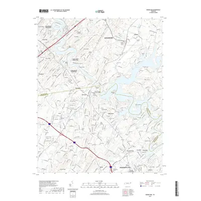
2019 Map of Boone Dam
USGS Topo · Published 2019About this map
Boone Lake and its intricate shoreline dominate the center of this Tennessee landscape, where the waters of the Watauga and Holston rivers converge. The suburban expansion of Kingsport and Johnson City is evident through numerous residential developments such as the Baker Bluff Subdivision and Smith Shoals Subdivision. Historically significant family and community sites are scattered throughout the hills, including Bethel United Methodist Church and dozens of burial grounds like Mount Lebanon Cem and Buffalo Ridge Cem. The presence of the Tri-Cities Airport in the northeast corner highlights the area's role as a regional transportation hub, while the surrounding terrain is defined by prominent ridges like Buffalo Ridge and the sharp drop-offs at Buzzard Cliff. This survey captures a modern portrait of a region defined by its reservoir-centered recreation and its shifting identity from rural hollows to a connected metropolitan corridor.
Find a feature on this map
299 named features on this map. Tap any name to fly to it.
Don’t see what you’re looking for? This feature index may not catch every label — zoom into the map to look around manually.
Map Details
Editions of this 2019 Boone Dam Map
This is the sole edition of this map. No revisions or reprints were ever made.
Other maps of this area

1891 · Roan Mountain
USGS Topo · 1:125,000

1892 · Greeneville
USGS Topo · 1:125,000

1894 · Roan Mountain
USGS Topo · 1:125,000

1894 · Estillville
USGS Topo · 1:125,000

1896 · Greeneville
USGS Topo · 1:125,000

1897 · Bristol
USGS Topo · 1:125,000

1902 · Bristol
USGS Topo · 1:125,000

1904 · Roan Mountain
USGS Topo · 1:125,000

1904 · Greeneville
USGS Topo · 1:125,000

1935 · Sullivan Gardens
USGS Topo · 1:24,000