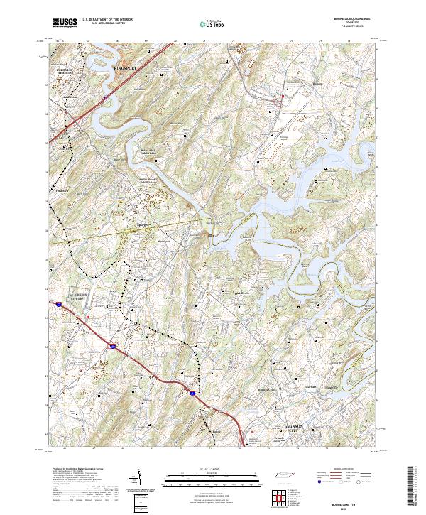
2022 Map of Boone Dam
USGS Topo · Published 2022About this map
Boone Lake and Fort Patrick Henry Lake dominate this landscape south of Kingsport, where the controlled waters of the South Fork Holston River shape the local geography. The map captures a high density of family and community cemeteries, such as Hales Chapel Cem, Buffalo Ridge Cem, and Beulah Community Cem, which serve as vital landmarks for genealogical research in Sullivan and Washington Counties. The development of the Tri-Cities Airport and the Northeast State Technical Community College campus reflects the region's modern infrastructure, situated alongside older established settlements like Spurgeon, Gray, and Boones Creek. Distinctive terrain features such as Buzzard Cliff, McAfee Bluff, and Spurgeon Island punctuate the river valley, illustrating the varied topography that surrounds the Interstate 81 corridor.
Find a feature on this map
99 named features on this map. Tap any name to fly to it.
Don’t see what you’re looking for? This feature index may not catch every label — zoom into the map to look around manually.
Map Details
Editions of this 2022 Boone Dam Map
This is the sole edition of this map. No revisions or reprints were ever made.
Other maps of this area

1891 · Roan Mountain
USGS Topo · 1:125,000

1892 · Greeneville
USGS Topo · 1:125,000

1894 · Roan Mountain
USGS Topo · 1:125,000

1894 · Estillville
USGS Topo · 1:125,000

1896 · Greeneville
USGS Topo · 1:125,000

1897 · Bristol
USGS Topo · 1:125,000

1902 · Bristol
USGS Topo · 1:125,000

1904 · Roan Mountain
USGS Topo · 1:125,000

1904 · Greeneville
USGS Topo · 1:125,000

1935 · Sullivan Gardens
USGS Topo · 1:24,000